CIRCUIT MOYEN (AMSV24)
in Saint-Micaud
9.2
km
Foot
2h 20min
Medium
-
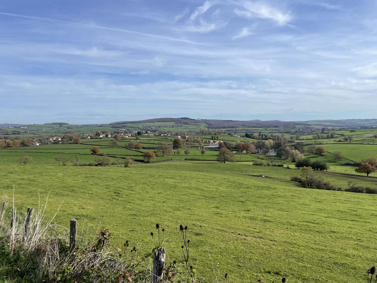
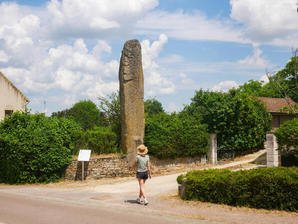
Between Montchanin and Saint-Gengoux-le-National, the commune of Saint-Micaud reveals a gentle, rolling landscape, typical of the Charolais bocage. During your walk, discover the Pierre aux Fées (Fairy Stone), one of the most beautiful menhirs in Burgundy, a mysterious witness to ancient times.
- Departure
- Saint-Micaud
-
-
Difference in height
- 184.12 m
-
-
-
-
-
Documentation
- GPX / KML files allow you to export the trail of your hike to your GPS (or other navigation tool)
-

- Points of interest
1
2
3
- 184 meters of difference in height
-
- Start altitude : 300 m
- End altitude : 300 m
- Maximum altitude : 400 m
- Minimum altitude : 269 m
- Total positive elevation : 184 m
- Total negative elevation : -184 m
- Max positive elevation : 54 m
- Min positive elevation : -56 m